 admin
adminIn Columbus, one of the most striking tracks on Hail H.I.M., the album Burning Spear released in 1980, Christopher Columbus is portrayed as a liar…
….
I and I reconsider
Christopher Columbus is a damn blasted liar
(…)
Yes, Jah
Ah, he is saying that, ah, he is the first one
Who discover Jamaica
I and I say that
What about the Arawak Indians and the few Black men
Who were ’round here before him?
(…)
…the phrase amounting less to gratuitous provocation than to a challenge to the dominant historical narratives that long served to legitimise Europe’s conquest of the world.
Behind this denunciation lies, in reality, a deeper inquiry into the mechanisms by which knowledge is produced, the most enduring forms of domination residing less in the occupation of territories than in the imposition of the categories through which they are thought, represented and ultimately administered, official history coming to appear self-evident while alternative narratives are gradually pushed to the margins.
In Sierragambie, this coloniality of perception continues to shape our understanding of space, manifesting itself notably in an assertion that has become almost a geographical reflex, namely that “The Gambia is an enclave within Senegal.” The phrase seems to go without saying, so often has it been repeated by administrations, school textbooks and political speeches, to the point that its ideological charge has become invisible. Yet, like every historical self-evidence, it deserves critical scrutiny, all the more so at a time when African societies are seeking to re-examine the categories inherited from colonisation in order to recover interpretive keys more faithful to their own historical trajectories.
Recent events invite us to do so with particular urgency. Following the military tensions around the Bullock border post in July 2026, the joint Senegalese-Gambian boundary commission launched a new phase of re-identifying and physically marking the border line by installing concrete markers intended to secure the internationally recognised limits between the two States. Presented as an essentially technical operation aimed at preventing possible territorial disputes, this initiative nonetheless raises a more fundamental question concerning the way we continue to think about the Sierragambian space, the markers not only delimiting a territory but also reactivating a spatial imaginary inherited from the colonial partition.
The Gambia’s hidden history: how a tiny river basin influenced colonial trade and slavery
Published: July 24, 2026 10.27am SAST
The River against the Border, or the Clash of Two Geographies
To grasp the full import of this question, a return to the very meaning of words is necessary. The Gambia takes its name from a river, and more precisely from a watercourse that for centuries served as a major axis for the movement of people, goods, knowledge and beliefs between the societies of the interior and the Atlantic seaboard. From the highlands of the Fouta Djallon to the ocean, the Gambia River connected diverse linguistic, political and religious communities, contributing to the formation of a relational space whose coherence rested less on the existence of a single centre of power than on the intensity of exchange.
The ambiguity lies precisely in the fact that history gave the name of a space of flows to a space of fixity, transferring to a modern State the name of a geographical reality that long predated it. On one side stands the river, belonging to a geography of movement and interconnection; on the other stands the modern State, belonging to a geography of sovereignty, territorial control and legal delimitation. The former naturally connecting what the latter exists to divide.
To think of The Gambia exclusively as an enclave thus amounts to privileging the gaze inherited from colonial cartography at the expense of a far older history, that of the circulations which shaped the Sierragambian space. This obviously does not mean that the international border does not exist or that it produces no political effects. It simply means that contemporary legal reality cannot exhaust the historical reality of the region, the latter having taken shape long before the diplomatic negotiations that led to the partition of West Africa among European powers.
The markers now being set along the border certainly materialise a line recognised by international law, while at the same time reactivating a territorial legacy devised during the last decades of the nineteenth century, a period in which the geopolitical imperatives of colonial empires overrode the historical dynamics of local societies. The point, then, is not to call into question the existence of contemporary States or the need for effective territorial administration, but to refuse the frequent confusion between the history of peoples and that of the borders which served as the matrix for building African nation-states.
Casamance, or the Historical Production of a Periphery
This reflection leads naturally to Casamance, or more precisely to Ajamaat Country, whose history remains largely deferred and whose writing constitutes one of the great intellectual undertakings of the coming decades. Like The Gambia, Casamance is generally conceived through contemporary territorial categories, often appearing as a peripheral space, remote from the national centre of decision-making and cut off from northern Senegal by Gambian territory. Such a representation nonetheless conceals a far more complex history, the region having long been a space of circulation, exchange and contact before being gradually reshaped by the logics of colonial administration.
The Franco-Portuguese convention of 1886, followed by the Anglo-French convention of 1889 and the many territorial adjustments that accompanied the consolidation of colonial empires, produced a new organisation of regional space, Casamance becoming progressively hemmed in between British Gambia, eastern Senegal, French Guinea and Portuguese Guinea. This process did not stop at drawing lines on a map; it also brought about a profound transformation of territorial representations, a space formerly woven into multiple networks of relations coming gradually to be seen as a separate, distant and marginal territory.
Casamance therefore did not become peripheral because it lay naturally at a distance from a centre. It became peripheral because a new political centre was established elsewhere, entailing a redefinition of spatial and symbolic relations within a wider whole. This historical shift, dating back to the nineteenth century, continues today to produce its effects on collective imaginaries, administrative discourse and popular representations, illustrating what might be called a deferred memory, that is, the persistence of past events within the mental structures of the present.
The Lived Border, or the Daily Reproduction of Separation
This reality appears with particular force in the everyday experience of travellers crossing the Senegalese-Gambian border. On the ground, the border cannot be reduced to a mere line drawn on a map. It becomes a social, psychological and sometimes emotional experience, the crossing of border posts often giving the impression of passing not only from one State to another but also from one mental universe to another. In ordinary interactions as in the language of administrative checks, it is not uncommon to hear that one is going “to Senegal” or “to Casamance,” as though the two realities were distinct spaces rather than components of a single national whole.
This representation is by no means innocuous, since it helps reproduce a symbolic separation far exceeding the legal function of the border. It also feeds a system of levies and intermediation thriving on territorial fragmentation, the proliferation of checks, formalities and procedures turning the border into an economic resource for numerous actors whose activity depends precisely on maintaining this spatial discontinuity.
The border then ceases to be exclusively an instrument of State sovereignty and becomes a mechanism of social, economic and psychological differentiation, continuing to weigh on regional mobility while reinforcing the notion that the spaces it separates are fundamentally distinct.
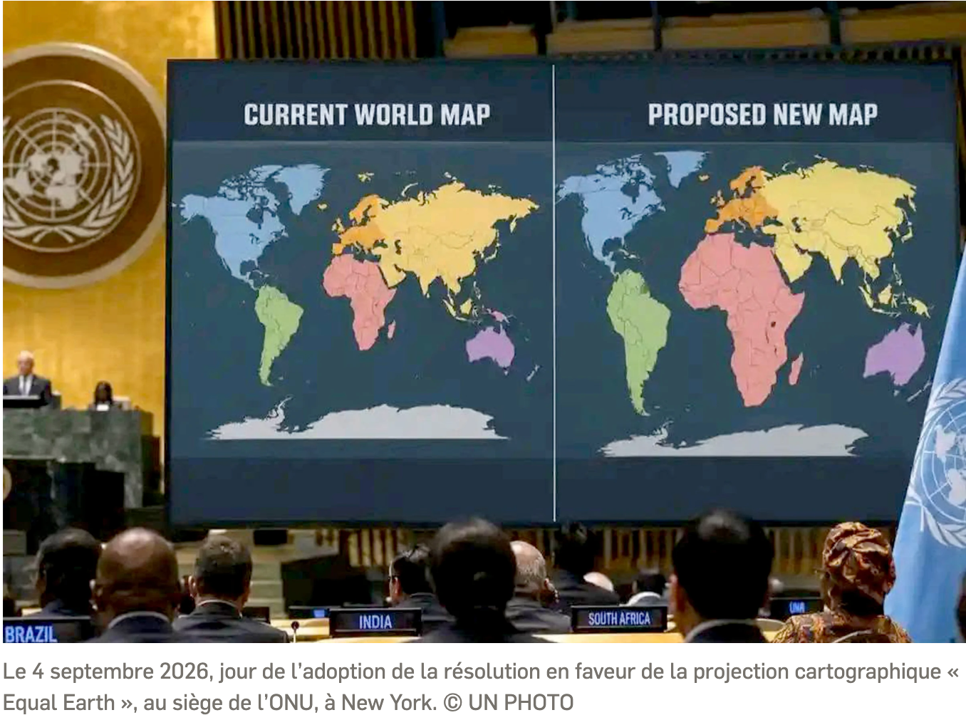
Decolonising the Mental Geography of Sierragambia
The current demarcation operations are not illegitimate in themselves, no modern State being able to forgo knowing and securing its territory. The question is therefore not whether the border exists, but what intellectual categories we continue to attach to it, sometimes reproducing, without being fully aware of it, the representations inherited from colonisation.
The challenge facing Sierragambia in the twenty-first century thus appears less cartographic than intellectual, less technical than memorial and political. Decolonising our space means neither denying existing borders nor nurturing the illusion of their imminent disappearance, but recognising their historical and contingent character, the principle of the inviolability of borders inherited from independence not being allowed to harden into an intellectual taboo forbidding any reflection on the human continuities that preceded it.
Such an approach requires restoring to populations full ownership of their memorial space while rehabilitating the historical, family, cultural, linguistic and economic continuities that long structured Sierragambie, these continuities constituting a heritage as real as the borders themselves and often far older.
For beyond the markers, the maps and the joint commissions there remains a reality older than empires, more enduring than administrations and more resilient than borders, that of a Sierragambia shaped by the circulation of people, languages, memories and rivers, human continuities having preceded the colonial partitions and continuing, in spite of them, to outlive them. Perhaps therein lies Burning Spear’s true lesson, the liberation of territories remaining unfinished so long as minds continue to inhabit maps drawn by others.
Proof, if any were needed, that he belongs to the intellectual rebellion…!
“Sierragambia, at once a space and a historiographical paradigm, taking as its task the deconstruction of territorialities inherited from colonisation and the restitution, without freezing them, of the historical, memorial and civilisational continuities of a segment of Atlantic West Africa that the imperial partition had fragmented.”
Pape Chérif Bertrand Bassène, Akandijack
Pingback: “Christopher Columbus is a… liar” : délimiter le tracé ou libérer les esprits ? – CASAɅVANCE